STORY OF SAI KUNG
The story began 400 years ago in what is now the High Island Reservoir of Hong Kong, where our ancestors living there. Surprisingly, 140 million years ago, there was an anicient supervolcano located at the same place...
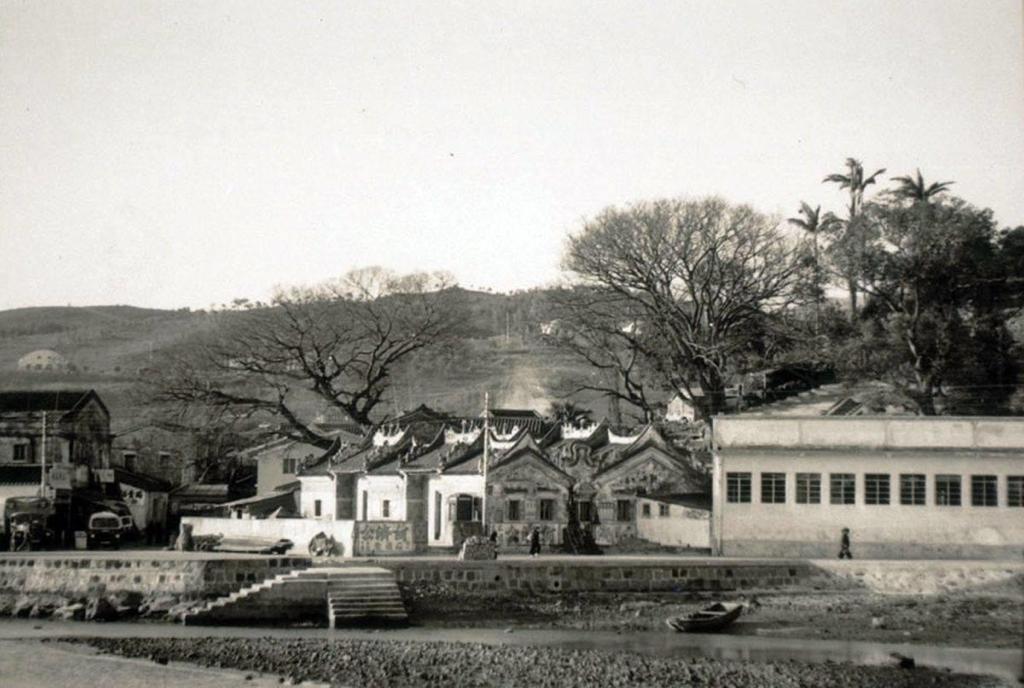
Sai Kung 400 Years Ago in 16 Century
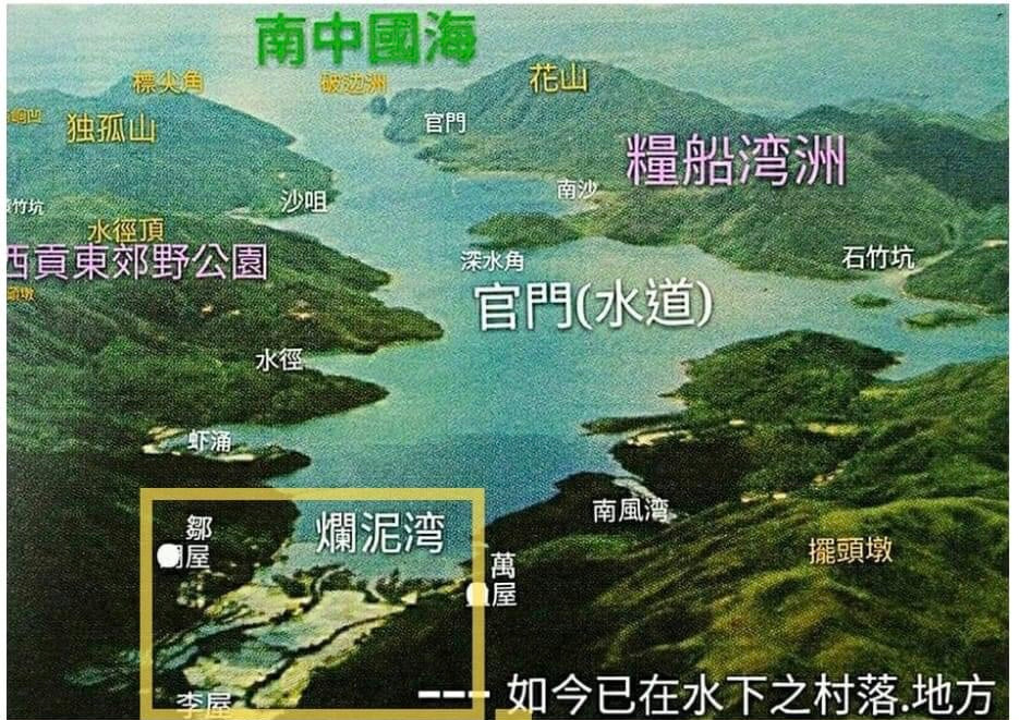
The story of Sai Kung began 400 years ago in what is now the High Island Reservoir. Before the reservoir was constructed, this area was known as the Kwun Mun Channel, a waterway bordered by several villages, including Lan Nai Wan, Guan Mun, and Sha Tsui. Among these, Lan Nai Wan Village boasts a history of over 400 years, with approximately 50 households and around 400 Hakka residents who relied on agriculture and fishing for their livelihoods.
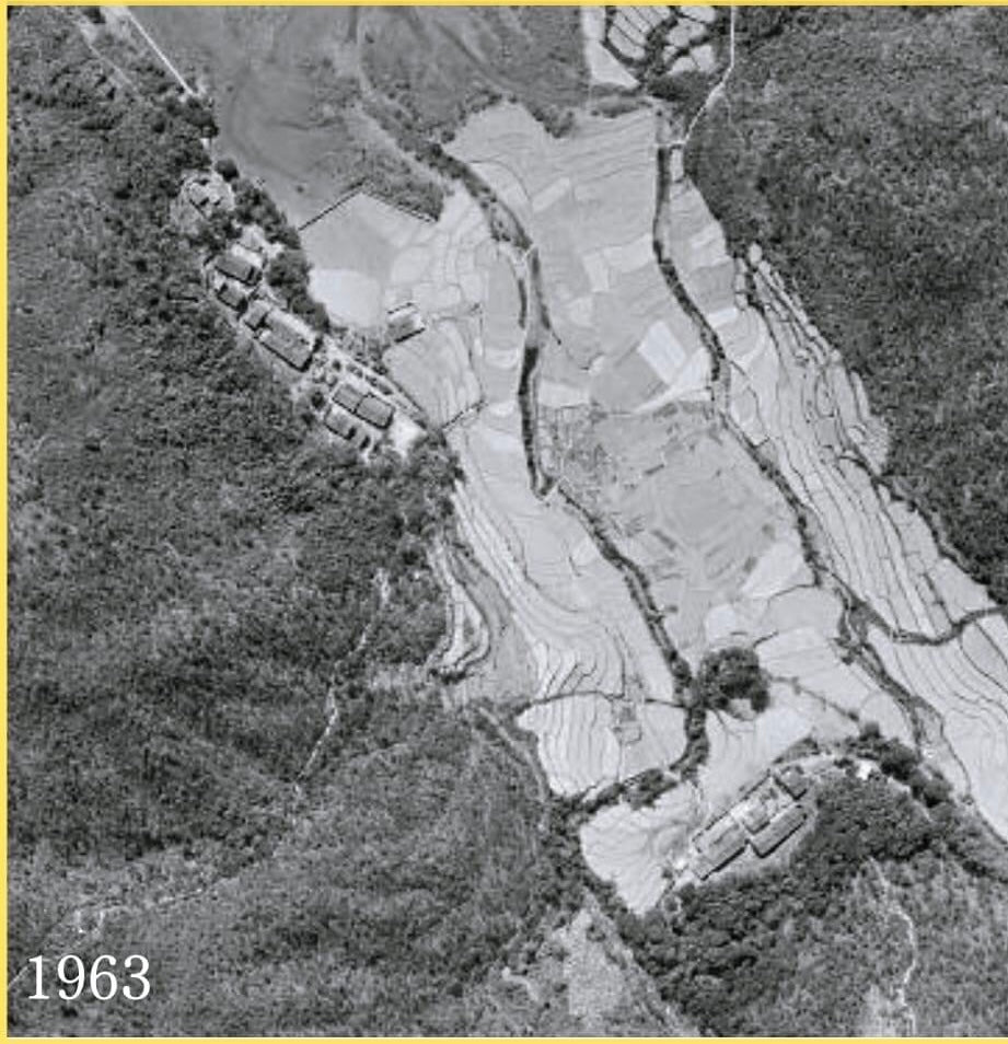
The Lan Nai Wan Village
The name Lan Nai Wan (爛泥灣), which translates to "Bad Soil Bay," derives from the sandy and silty conditions of the area. The bay was characterized by deposits of sand and silt accumulated by sea currents, making it difficult to walk on when wet. This description reflects the geographical features of the location, which influenced its naming by the villagers.
Construction of High Island Reservoir
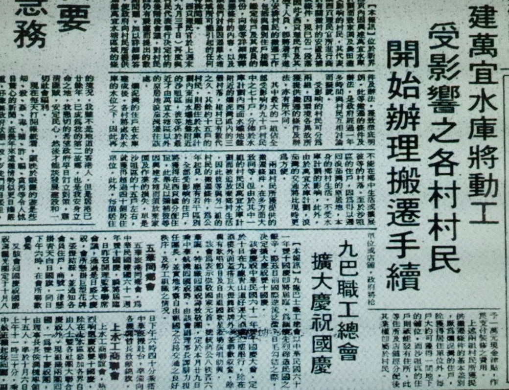
In the late 1960s, the Hong Kong government announced plans to construct the High Island Reservoir to address water shortages. This development necessitated the relocation of several villages, including Lan Nai Wan and Sha Tsui. The construction submerged these communities under rising waters, leading to significant changes in the lives of their residents.

Relocation of the Villagers
In 1974, the residents were relocated to new housing developments in Sai Kung, where ten five-story buildings were constructed to accommodate them. This transition was not without its challenges, as villagers had to leave behind their ancestral homes and adapt to unfamiliar living conditions. Despite receiving compensation for their relocation, many felt a deep sense of loss for their heritage and the vibrant community they had built over centuries.

From Lan Nai Wan to Man Yee Wan: A New Name for a New Beginning
"Man Yee" translates to "everything will be desirable," reflecting the villagers' aspirations for a brighter future in their new settlement. The renaming was not just a change of place but also a profound gesture of resilience, representing a fresh start for those who had to adapt to new surroundings while preserving their cultural identity. The streets of Man Yee Wan are named to honor this spirit of renewal, ensuring that the legacy of Lan Nai Wan lives on in the hearts and memories of its former residents.

SAI KUNG PUBLIC SCHOOL IN 1946
Sai Kung Public School holds significant historical value as one of the earliest educational institutions in the Sai Kung area, established in 1946. Originally located on Po Tung Road, the school was founded to meet the growing educational needs of the local community following World War II. It played a crucial role in providing accessible education to children during a time of rapid population growth and social change.
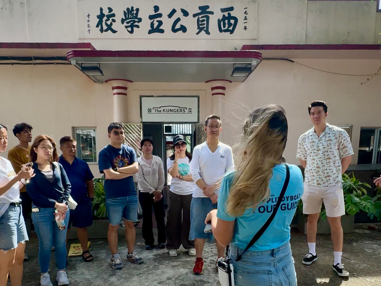
SAI KUNG PUBLIC SCHOOL: From Abandonment to Landmark of Sai Kung Town
In the late 1960s, as the community expanded, the original building became insufficient, leading to its relocation to a new modern facility. This transition marked a period of abandonment for the original site, which now stands as a historical landmark reflecting the evolution of education in Sai Kung. The legacy of Sai Kung Public School continues to resonate within the community, symbolizing resilience and the importance of education in shaping future generations.

Transforming Heritage: Sai Kung Public School's Role in Geology Education
In alignment with the development goals of the Hong Kong UNESCO Global Geopark, our company, Splitdyboat, has found a new purpose for this historic site. We aim to transform Sai Kung Public School into an educational hub that informs travelers from around the world about the region's rich geological and cultural history. By utilizing this landmark, we seek to foster a deeper appreciation for Sai Kung's unique natural landscapes and heritage, ensuring that the stories of its past continue to inspire future generations.
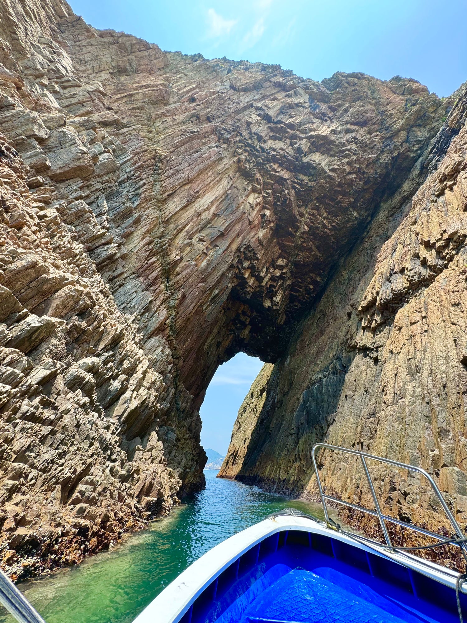
Establishment of Hong Kong UNESCO Global Geopark
The Hong Kong UNESCO Global Geoparkwas inaugurated on November 3, 2009, to conserve the region's unique geological heritage and promote geoeducation. It encompasses two main geological regions: the Sai Kung Volcanic Rock Region and the Northeast New Territories Sedimentary Rock Region. On September 18, 2011, the geopark was recognized by UNESCO, enhancing its international significance. The Sai Kung Volcanic Rock Region is especially noted for its striking volcanic formations, including hexagonal basalt columns and distinctive coastal landscapes that showcase the area's volcanic history dating back 140 million years.
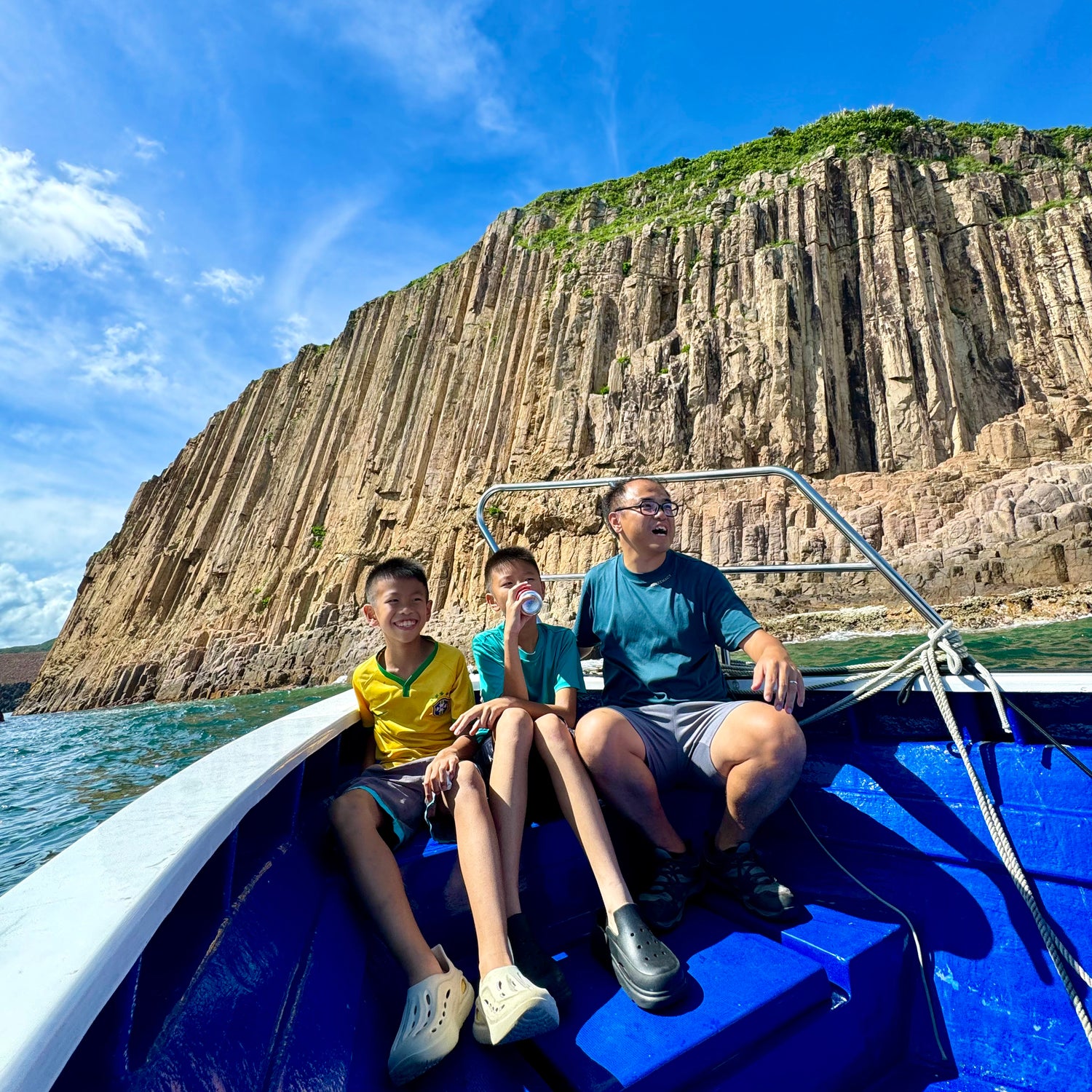
The Hong Kong UNESCO Global Geopark - Sai Kung Volcanic Rock Region
The Sai Kung Volcanic Rock Region, part of the Hong Kong UNESCO Global Geopark, is renowned for its stunning geological features formed by volcanic activity approximately 140 million years ago. This area showcases a remarkable landscape of hexagonal rock columns, sea stacks, and unique coastal formations, all resulting from ancient supervolcanic eruptions. The region covers over 100 square kilometers and includes notable sites such as High Island and Sharp Island, where visitors can explore well-preserved volcanic tuff and intricate rock formations. With its breathtaking scenery and rich geological history, the Sai Kung Volcanic Rock Region serves as an important site for both scientific study and eco-tourism, attracting travelers eager to learn about the natural wonders of Hong Kong.
